| Itteringham.com |
Many interesting facts and snippets relating to the history of the village are listed below and several links to associated pages are included within the text. |
|
The Concise Oxford Dictionary of English Place Names says the following: Itteringham [U(l)trincham DB, Itringham 1203 Cur, 1242 Fees, Iteringham 1202FF] Either the 'HAM of Ytra's or Ytri's people' or 'the HAM of the people dwelling outside'. Ytra (Ytri) might be derived from Otr (cf. OTTERDEN). In the second alternative the first el. would be derived from OE yterra 'outer'. |
|
William de Warenne from Varenne, near Bellencombre, Seine-Inf fought with William 1 at the Battle of Hastings in 1066. In 1088 he was created Earl of Surrey and given lands in 13 counties (though curiously none in Surrey). These lands comprised of 233 parishes of which 116 were in Norfolk, including Itteringham. In modern money his holdings would be worth some £57 billion - a record in Britain during the last millenium. He died in the same year of 1088, shot by an arrow. |
John Mortoste was Lord of the Manor in 1522 |
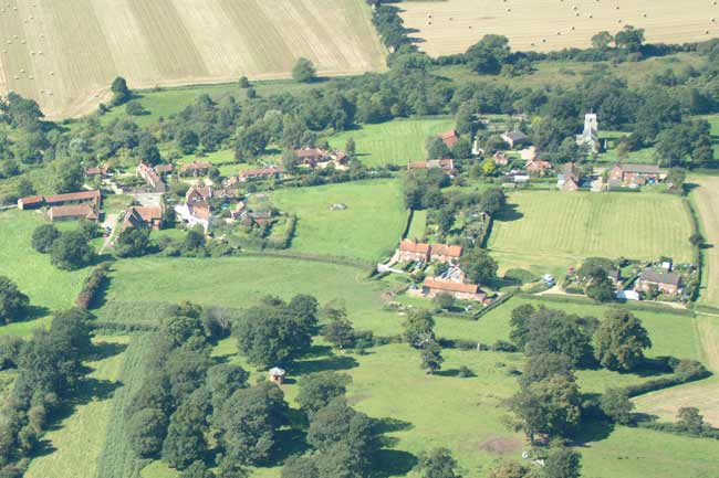 |
Looking west - 4th September 2004 |
LADY POTTS’S CHARITY In an old overseer’s book there is a memorandum, dated 25th March, 1699, stating that Thomas Robins and Richard Robins had, with the churchwarden, purchased of Sir Roger Potts a piece of land at Broomhill in Itteringham, containing two acres, and that the said Thomas Robins had paid for the purchase ?????? that the land was purchased for the use of the poor of Itteringham as by a deed of ??????? (the date not mentioned) would appear; and that it had been agreed that the sum of 18 l. should be raised as follows; viz. “that ??????? thereof was a gift of the Lady Potts, late wife of Sir John Potts, deceased, ?????? and gave to the use of the poor, and that 10 l. should be raised by the overseer by collecting the same of the said parish, 20s. yearly; and that it was also agreed that the overseers should receive the rent of the land, paying out of the same 8s. a year as interest of the 8 l. given by Lady Potts; and that the rest of the rent should be disposed of as the chief inhabitants of Itteringham should think meet; and that it should be lawful for the inhabitants to take gravel upon the said land for repairing the highway. We could not discover that there were any deeds now in the parish relating to this land. There is a close, containing two acres, the greater part of which is a gravel pit, used by the inhabitants. The residue is let to Henry Smith, as yearly tenant, at 8s. per annum, which appears to be the fair value thereof. The sum of 8s. is divided equally amongst eight widows, appointed by the acting overseer. |
In 1836 Mannington had 13 inhabitants. Mossymere so called from the large ponds supplied by copious springs, which by washing away substration, so undermined the surface that 3 large oaks suddenly sunk into 2 deep pits on 23rd July 1717. |
Faden's map of 1797 shows that there used to be a post windmill on the common land to the west side of the road between New Road and the B1354 at approximately TG14802930, which is actually just in the parish of Oulton |
The Holt and Norwich coach passes through the village on Mon. Wed. and Sat. |
On the Church bell at Wickmere which being cracked was sold to Horace Earl
of Orford and moved to Mannington Hall - was the following inscription |
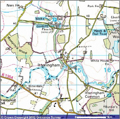
| The soil is sand and gravel with various subsoils. In 1845 the area was 1,442 acres and by 1937 the area was 2,024 acres of land and inland water. |
In 1984 a series of gravel pits were excavated. During their excavation a digger driver unearthed the skeletal remains of a mammoth... This link will take you to a page about the history of Itteringham's Gravel Pits |
On 16th July 1986 the probable site of Nowers manor and its long lost church of St Nicholas was discovered, having shown up as crop marks that were subsequently recorded by aerial photographs. |
The parishes of Itteringham and Mannington were formally ...consolidated into one joint benefice and one rectory on 17th March 1780 after the joint petition of Lord Walpole and the Reverend Mordaunt Leathes who both held livings in the gift of Lord Walpole. It was judged that ...the livings together make a moderate provision for a minister. |
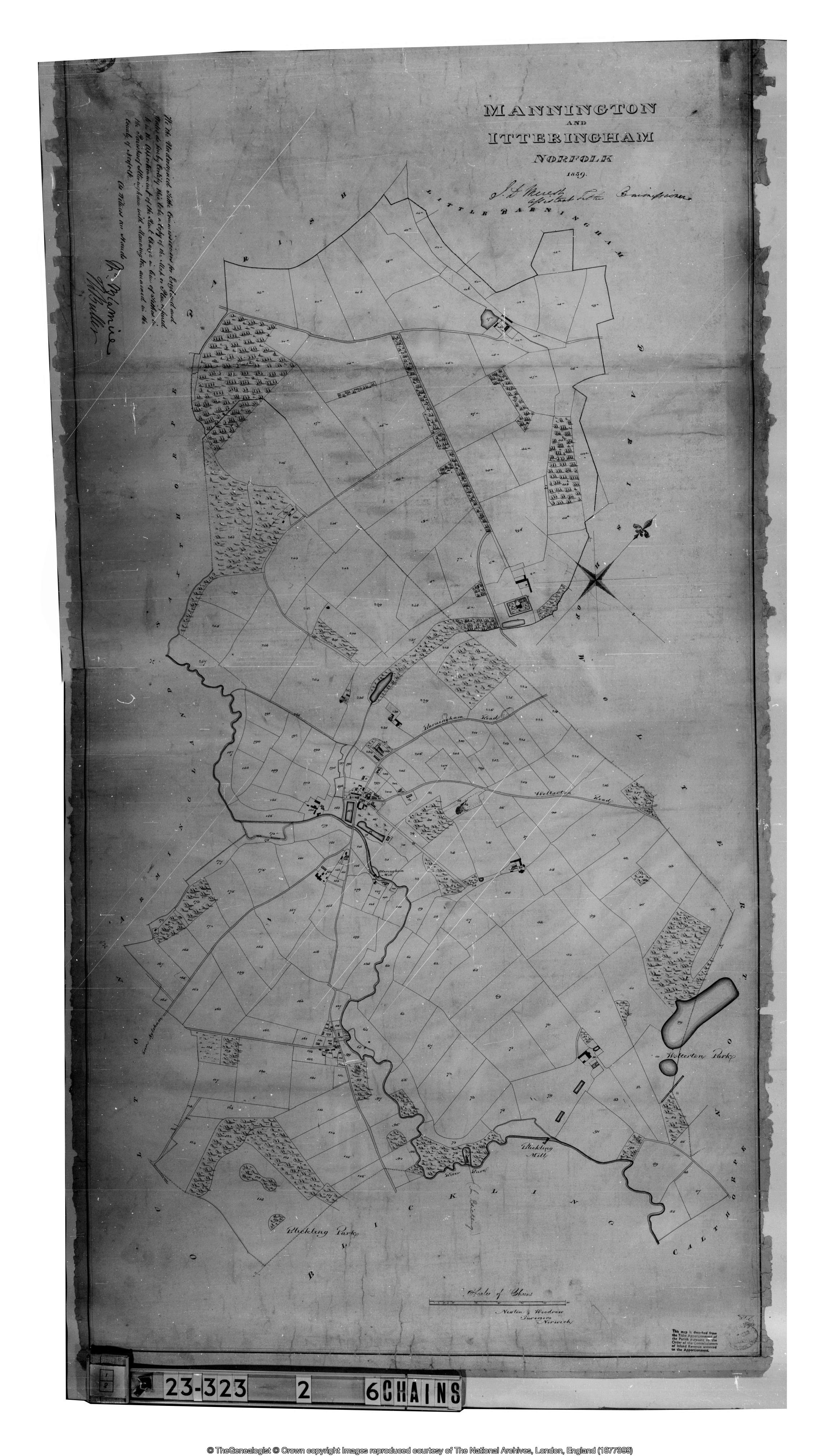
At the time of the Enclosure Act of 1823 the number and location of houses in the village was quite different to the layout of 2000. This is graphically illustrated on the Itteringham Enclosure Map 1823 |
In 1841 James Brown was still the tanner and the tanyard was at Bintry Farm. The 1845 Voters List shows James_Brown as an occupier near the bridge paying £50 rent per annum. On 27th July, 1858 James Brown submitted detailed plans for changing the use of the buildings from a tan yard to a farm. His plans were rejected on the grounds that the fabric of the buildings was not strong enough to withstand the new use, however it appears he went ahead anyway. |
If you have any memories, anecdotes or photos please let us know and we may be able to use them to update the site. By all means email or telephone 07836 675369 |
Copyright © Jonathan Neville 2025 |