Itteringham.com |
|
The hill leading out of Itteringham towards Aylsham is called the Sovereigns because a wagon once lost a wheel there and the contents fell on the wayside. However, some sovereigns were never found and so the name remains to this day. |
A less interesting but more probable explanation is that the name is a corruption of the name of an old narrow field called The Severals, which ran down the right hand side of the road towards the village. Ivan Thompson remembers the Sovereigns as running from the second field down to Hill Farm. This ties in with a map showing the field name as The Severals at the time of a letter of agreement showing the the field to be owned by Mary Churchman. Before the Act of Enclosure it was part of the roadside heath lands leading to the Common. The field next to it was called Poverty because of it's poor field structure! |
The council houses on Church Road and Wolterton Road were built in 1951. Originally it was intended that all the houses would be built along the length of Church Road and none along Wolterton Road. |
Mr Hall was the man who had the forge. I've been and blew the bellows for him once, pumped the bellows for him cause we lived opposite (13 Church Row) and if he was in a good mind he'd let you in to see the fire and the horses being shod and you had to keep out of the way. Ruth Harrison |
2 acres of land, mostly a gravel pit was purchased in 1699, with £8 given to the poor by Lady Potts and £12 subscribed by the parish. Whites 1845 The land is next to the Broom Hill and is rented out. However, the Parish Council is still responsible for distributing the proceeds to designated residents of the Parish. |
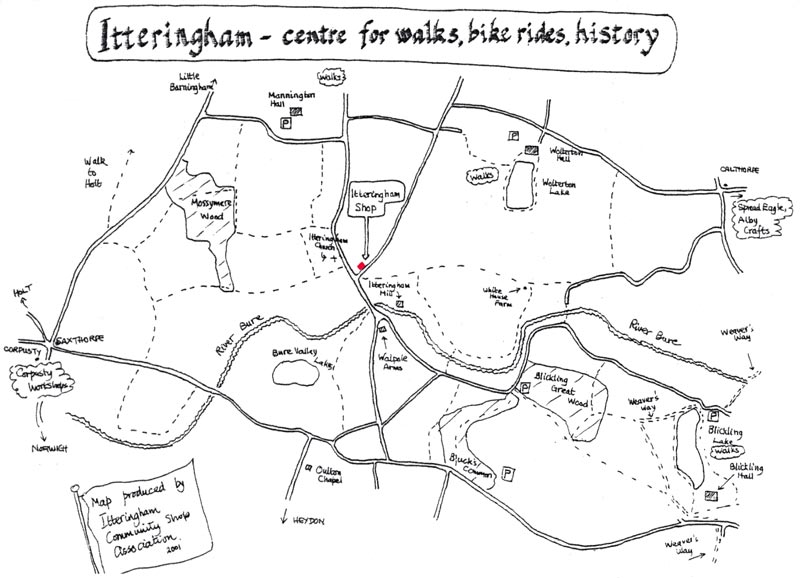
The Broom Hill is so called because broom was grown there. A summer house is on the summit, this was used by the lady of the manor for restful afternoons. |
Broom Hill Summerhouse Summerhouse on hill top, dated 1765. Brick with black glazed pantiles to octagonal hipped roof. Octagonal, single storey. Upper brickwork renewed. South facing open doorway under cambered arch; blind rectangular window above with a central brick inscribed TR/1765; opening to east; blind opening to west; projection at rear as for external chimney stack or buttress. Interior: rendered walls to single oval room; two conch headed niches to rear. English Heritage |
Robin Farm once formed part of the Mannington Estate which was called Mannington Mere Farm. Lord Robert Walpole rented some of the land to Edward (Ted) Prior who asked Lord Walpole to name the farm house. Lord Walpole replied that he had a new born son whose name is Robin, so Robin Farm it became. The track leading up to the house was known as Prior's Loke. |
One winter's night two woodmen became trapped because of the snow and were forced to shelter at the keeper's cottage in Mossymere Wood. The gamekeeper's wife washed the sheets before making up the beds and as a result the poor woodmen caught pneumonia and both died. |
White House Farm is situated on the outskirts of the parish, being part of the Wolterton Estate. It is said that General Ironside once resided there. Fields leading up to the White House are called Esther's, which is a Jewish name. The Babylonian form is Hadassah, which means myrtle. On land close to this area (opposite to the Common) are the footings of St. Nicholas' Church, long forgotten and known to very few people. There are also stories of an ancient monastery on the marshlands.
|
| Maundy Money was distributed to the poor in times of great hardship. |
It is rumoured that an old pub known as The Artichoke was once in the Big Yard. There used to be a beerhouse on the Wolterton Road that was once run by Robert Lee the village ratcatcher. For years locals have been known to call the Walpole Arms by the name Artichoke. |
| Itteringham village stocks are preserved in Norwich Castle Museum dungeons. |
My most vivid memory of Itteringham is the severe winter of 1947. At one point the village was cut off by heavy snow drifts and I recall grandfather taking me up to the road by the church to see several men, including my father, digging out the snow and throwing it over the banks. The snow was as high as mountains but then I was just three years of age!
Later, we went down to the bridge and I witnessed chains on car wheels. |
My one and only memory of Itteringham. During the Great Storm of 1987 i was stationed at Gt Yarmouth Fire Station,we had responded to numerous calls for assistance through out the night and day to many rural areas,when ,as we were parked up in Stalham High St for a well earned rest and a fish & chip meal we received a call to flooding in Itteringham.We all looked at each other as to where Itteringham was,nobody on the appliance had ever heard of it,out came the maps of Norfolk (no sat-navs in those days) until we located it.,it was then a journey of some 15 miles through tiny country lanes covered in flood water and storm debris,we arrived to find that the village pub,(The Walpole Arms i think ) under about 3 foot of water. Needless to say we were there for quite a while pumping out with no where for the water to go. Happy Days Peter Hubbard - January 2020 The Walpole arms was indeed under water but it was still open and the weekly quiz still went on. We were all there in wellie boots. Jonathan Neville |
If you have any memories, anecdotes or photos please let us know and we may be able to use them to update the site. By all means telephone 07836 675369 or
|
Copyright © Jonathan Neville 2023 |